
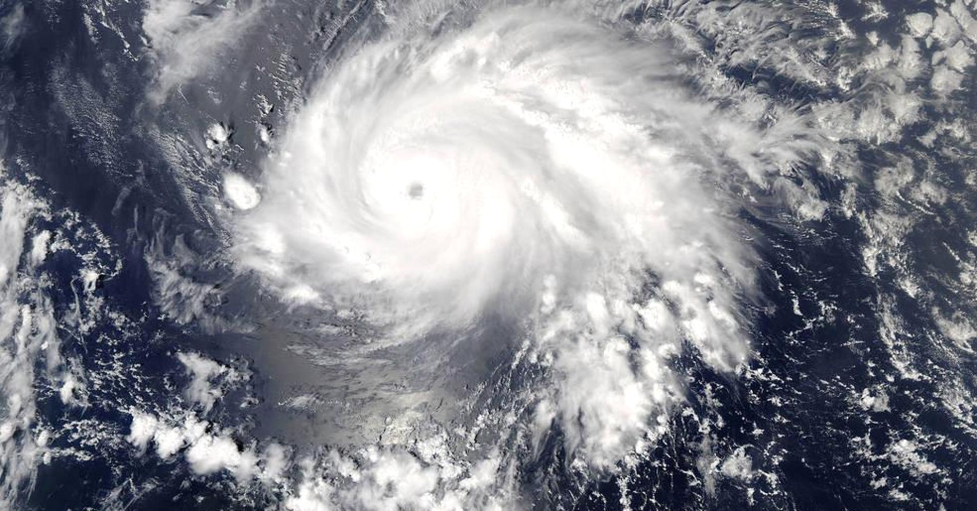
Hurricane Maria has intensified into an extremely dangerous Category 4 hurricane on the five-step Saffir-Simpson wind scale and is expected to strengthen further, the U.S. National Hurricane Center (NHC) said on Monday.
Hurricane Maria was about 35 miles (55 km) northeast of Martinique, with maximum sustained winds of 130 miles per hour (215 km per hour), the Miami-based weather forecaster said.
“The center of Maria will move near Dominica and the adjacent Leeward Islands during the next few hours, over the extreme northeastern Caribbean Sea the remainder of tonight and Tuesday, and approach Puerto Rico and the Virgin Islands Tuesday night and Wednesday,” the NHC said.
Earlier, the Governor of Puerto Rico, Ricardo Rosselló, declared a state of emergency and activated the National Guard.
“Our call is for people to evacuate areas that are prone to floods and landslides ,in addition to vulnerable structures,” said Governor Rosselló.
“We are informing citizens that it is time to seek refuge with a family member, friend, or move to a state shelter because rescuers will not go out and risk their lives once winds reach 50 miles per hour,” said the Governor.
Maria was expected to be the second major hurricane this year to hit the Leeward Islands, which were hammered by Hurricane Irma earlier this month, the center said.
Streets were flooded in some residential parts of the island of Barbados, which had been experiencing heavy rain since Sunday as the storm approached.
Maria was expected to bring storm surges — seawater driven ashore by wind — of up to 6 feet to 9 feet (1.8-2.7 m), the NHC said. Parts of the central and southern Leeward Islands could see as much as 20 inches (51 cm) of rain, it said.
Hurricane and tropical storm warnings and watches were in effect for a string of islands in the area, including the U.S. and British Virgin Islands, Antigua and Barbuda and the French-Dutch island of Saint Martin.
Several of those islands were devastated earlier this month when Hurricane Irma rampaged through the Caribbean as one of the most powerful Atlantic hurricanes ever recorded, killing more than 80 people on the islands and the U.S. mainland.
Puerto Rico, a U.S. territory which Irma grazed as it headed toward Cuba and Florida, opened shelters and began to dismantle construction cranes that could be vulnerable to high winds as it prepared for Maria.
“It is time to seek refuge with a family member, friend, or move to a state shelter because rescuers will not go out and risk their lives once winds reach 50 miles per hour,” Puerto Rico Governor Ricardo Rosselló told reporters on Monday.
Some 450 shelters were open with space for 62,714 people, including one in San Juan that is already housing people evacuated by nearby islands hit by Irma, the government said.
More than 1,700 residents of Barbuda were evacuated to neighboring Antigua after Irma damaged nearly every building there.
Further north, forecasters were also tracking Category 1 Hurricane Jose, which was carrying 75-mph (120-kph) winds and was located about 265 miles (430 km) east-southeast of Cape Hatteras, North Carolina.
The eye of that storm was forecast to remain off the east coast of the United States for the next few days, bringing dangerous surf and rip currents to beaches from Delaware through Massachusetts.
WATCH: Here’s why there’s no such thing as a Category 6 hurricane